About Castle Rock Trail
Climb Castle Rock for 360-degree views over Mahone Bay and the South Shore. Three well-marked routes suit every fitness level, with the final 100 m scramble to the summit the only real challenge. Year-round hiking, mountain biking and trail running on the Chester Connection section of the Rum Runners Trail.
Features & Highlights
Detailed Information
Castle Rock is the summit hike that South Shore locals send visitors to first. Rising above the village of East River, about 20 minutes from Chester, this granite lookout delivers a full 360-degree view over Mahone Bay, its islands, and the Atlantic beyond — and it does it in an outing that suits everyone from families to trail runners. Three clearly marked routes climb to the top, and the final 100 metres is the only section that asks for real effort. It is the kind of walk that belongs on every South Shore itinerary, and it is free to do any day of the year. For more ideas in the area, see our South Shore Guide.
The trail is managed by the Municipality of Chester Recreation and Parks, which keeps the three routes well marked and publishes a downloadable map. The hike is consistently rated one of the most popular trails in Nova Scotia on AllTrails, where it holds a 4.5-plus star average from more than 800 reviews. The payoff is direct: a broad, open summit with water in every direction, reached in under two hours by most hikers.
The Approach: Chester Connection Trail
The outing begins at a free parking lot on Highway 329 at the edge of East River village, near the junction of Highways 3 and 329. From there you follow the Chester Connection section of the Rum Runners Trail, a converted rail bed that rolls gently north through Acadian forest, past ponds, streams, and small lakes. It is flat, wide, and easy underfoot — the kind of path that makes the first part of the day feel like a warm-up rather than a climb.
After about 3.2 kilometres you reach the Castle Rock trailhead at the north end of Labrador Lake, where a signboard shows the three routes to the summit. Mountain bikers often ride this approach, and the trail is shared, so keep an eye out and yield to faster trail users. In wet weather, the old rail bed can hold puddles, but it never gets technical.
Three Routes to the Summit
The Recreation and Parks team describes the three routes in plain terms, and each is well marked with Castle Rock emblems on the trees.
The easiest route follows the old tree-lot road uphill. It is an open, gentle slope with occasional loose rocks and wet patches, and it climbs steadily to the base of the rock without any steep sections. This is the route most families choose, and the one to pick with younger children or anyone who wants a relaxed pace.
The moderate route begins on the same old road, then follows a side road into the woods. The path is wet in spots but otherwise open, with a steady, moderate climb to the base of the rock. It adds a little variety and a little more effort than the easiest line without demanding much in return.
The most difficult route ascends steeply uphill, plateaus briefly, then takes a left-hand turn into the woods. From there the path is narrow and steep in places, with short rock step-ups and downs, and it eventually rewards you with a close view of the front side of the cliffs. It is the route for hikers who want a workout and a look at the rock itself.
Whichever route you take, the three lines converge at the base of Castle Rock's summit block, and the final decision is the same for everyone.
The Final Scramble
No matter which trail you choose, the last 100 metres onto Castle Rock is a scramble. The rock is granite, the holds are obvious, and the drop is manageable, but it is still a hands-on section — the only part of the day that demands care. The Municipality of Chester advises hikers to scout the line that suits them before committing, and most people find a route up the right-hand side easiest. Dogs can manage it with help, but small or nervous dogs may need to be carried or left below with a second person.
Once you are on top, the effort fades fast. The summit is broad and mostly flat, with plenty of room to sit, spread out a picnic, and take in the view.
Views from the Top
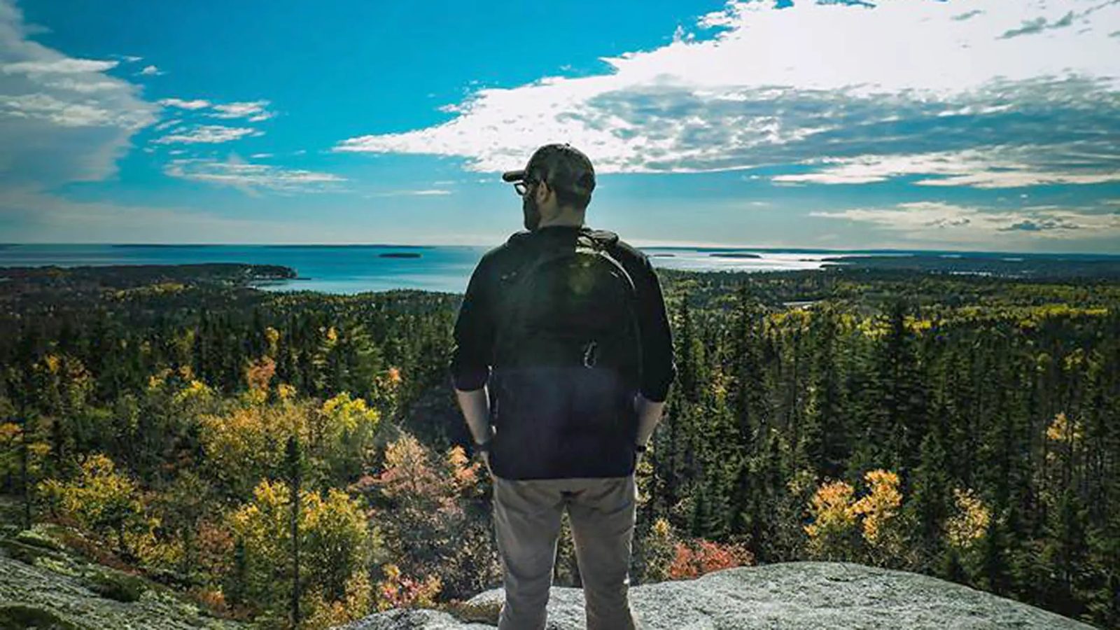
The summit view is the reason Castle Rock has become a South Shore institution. To the west, Mahone Bay's three iconic churches line the waterfront of the town itself, with the bay's islands — including Big Tancook and Little Tancook — scattered across the water. To the south, the Atlantic opens up past the mouth of the bay, and on clear days you can pick out the distant lighthouse at Peggy's Point and the profile of Oak Island. Inland, the forested ridges of the South Shore roll away toward the horizon.
Tourism Chester runs the #CastleRockClub, a low-key community campaign that invites hikers to take a photo at the summit, tag it with the hashtag when they share it, and join the growing list of Castle Rock climbers. It is a nice ritual for first-timers and a running joke among locals who have made the climb dozens of times.
Year-Round on the Trail
Castle Rock is open year-round and is popular in every season. Spring brings the fullest streams and the greenest forest along the approach. Summer is the classic season, with long evenings and the best visibility from the summit. Autumn is many locals' favourite: the hardwood stands along the trail turn gold and red, and the bay below is at its most colourful. In winter, the trail becomes a snowshoe route, though the parking lot and trail are not maintained, so expect snow-covered sections and icy patches on the scramble. Mountain bikers use the approach trail in all but the deepest snow, and trail runners treat the three routes as a dependable hill workout.
The Practical Details: Location, Hours and Essentials
Address and Location
Parking is at 7846 Highway 329, East River, Nova Scotia, near the junction of Highways 3 and 329, about 20 minutes' drive from Chester and 15 minutes from Mahone Bay. The trailhead is 3.2 km up the Chester Connection Trail from the parking lot.
Trail Length and Time
The full return trip from the parking lot, including the approach and the climb, is about 8.2 km and takes roughly three hours at a relaxed pace. The summit itself is reached about 4.1 km from the car.
Hours and Season
Open year-round, dawn to dusk. No winter maintenance; parking lot and trail may be snow-covered from December through March.
Parking
Free gravel parking on Highway 329. The lot fills early on summer weekends and holiday Mondays — arrive before 10 AM in peak season.
Difficulty
Three marked routes from easy to challenging, all converging at the same summit scramble. The final 100 m requires hands-on scrambling; sturdy footwear is recommended.
Dogs
Allowed on leash. The final scramble may be difficult for small dogs.
Contact
Municipality of Chester Recreation and Parks: (902) 275-3490, recreation@chester.ca. A printable trail map is available from the Municipality of Chester website.
Castle Rock is the South Shore's easiest big payoff — a proper summit with an ocean view, reached on trails that respect your skill level. It works as a family morning out, a training climb for longer hikes, or a sunset picnic spot, and it costs nothing but the drive. Pair it with lunch in Chester or Mahone Bay, and you have the makings of a perfect day on the South Shore.