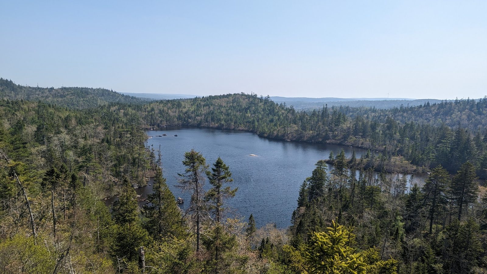
About Musquodoboit Trailway
Hike or bike 41 km of trails along the Musquodoboit River: an easy 15 km former rail trail with kilometre markers and naturalist signage, plus rugged backcountry loops like Gibraltar Rock and Skull Rock with sweeping look-off views. Wheelchair- and stroller-friendly sections make it accessible for all ages.
Features & Highlights
Detailed Information
The Musquodoboit Trailway is the Eastern Shore's answer to the province's big-name trail systems: 41 kilometres of non-motorized trails wrapped around the Musquodoboit River, with an easy flat rail trail for families and a network of rugged backcountry loops for hikers who want real wilderness. Run by a volunteer association that has spent decades building and maintaining the system, it sits barely an hour from downtown Halifax, which makes it one of the most accessible full-day hiking destinations in the province. For more Eastern Shore ideas, see our 100 Wild Islands guide.
What makes the trailway unusual is the range it covers in one outing. You can push a stroller along the old rail bed in the morning and be scrambling up a granite ridge to a river overlook by the afternoon. The trail system combines a 15 km former railway — part of the Trans Canada Trail — with five wilderness loops that climb onto the rocky ridges above the river valley. It is free, open year-round, and largely built and maintained by volunteers with the Musquodoboit Trailway Association.
The Rail Trail: A Flat Ride for Everyone
The spine of the system is the old railway line, which runs from the Caboose Information Centre at the Musquodoboit Railway Museum in Musquodoboit Harbour up the valley to the Gibraltar parking lot on Highway 357. It is a wide, packed gravel path with kilometre markers, gentle grades, and naturalist signage along the way. The first stretch crosses Highway 357, passes the arena and ball fields, and links up with the official trailhead at the Park Road parking lot — the most popular starting point.
About 250 metres from the Park Road lot, a restored 130-foot steel trestle bridge carries the trail across the Musquodoboit River. It is the trail's signature viewpoint, with benches where you can watch the broad flood plains below and, with luck, spot osprey and bald eagles working the water. Beyond the bridge, the trail passes picnic shelters, lake access points at Bayer Lake, and wetland views before climbing gently toward the wilderness trail junctions.
The rail trail is one of the most wheelchair- and stroller-friendly routes in Nova Scotia. The surface is firm and mostly level, and several sections are accessible for mobility devices. Cyclists use it year-round, and it is a favourite winter route for fat bikes and snowshoers once the snow settles.
The Backcountry Loops: Ridge Lines Above the River
Branching off the rail trail are five wilderness loops maintained by the association, each climbing onto the granite ridges that frame the valley:
- Gibraltar Rock Loop (1.3 km): The most popular backcountry loop, accessed from the Gibraltar parking lot on Highway 357. It climbs steeply through mixed forest to Gibraltar Rock, where the look-off gives a bird's-eye view of the river, the highway below, and the Shubenacadie glacial spillway to the north. The climb is short but unrelenting — most hikers take 45 minutes to an hour.
- Admiral Lake Loop (5.2 km): A challenging loop that leaves the rail trail about 1.7 km from Park Road and climbs into open barrens of blueberry bushes and low saplings — a reminder of the 1973 forest fires that swept the ridge. It circles Admiral Lake with several look-offs and lake access points, and is the trailway's classic half-day hike.
- Bayer Lake Loop: A shorter connector loop that branches off the Admiral Lake Trail about 170 metres in, circling Bayer Lake with sandy spots, benches, and a covered picnic shelter. Great for a lake swim on a warm day.
- South Granite Ridge: A wilderness route that leaves the rail trail 2.6 km from Park Road and runs along the southern ridge. This is a full-day or multi-day undertaking for experienced hikers with route-finding skills.
- North Granite Ridge (9.3 km): The longest wilderness trail, starting from the Gibraltar parking lot and following the ridge through old-growth hemlock and granite barrens. Plan for a full day, and carry a map — the ridge trails are marked but remote.
Wildlife and Scenery Along the River
The Musquodoboit River valley is one of the richest wildlife corridors in the Halifax area. The rail trail alone shelters scores of bird species, from kingfishers and great blue herons along the water to bald eagles circling the ridges. Snapping turtles sun themselves on logs in the slow stretches of the river, and beaver lodges are visible from several viewpoints. In late summer, the open barrens along the ridge loops are thick with blueberries and blackberries — a bonus for hikers who time their trip right.
The scenery shifts with the seasons. Spring brings the highest water on the river and the greenest forest floor. Summer is the classic season for swimming at Bayer Lake and the river access points. Autumn is arguably the best, when the hardwood stands turn gold and the granite ridges glow in the low sun. Winter turns the rail trail into a snowshoe and fat-bike corridor, while the ridge loops offer a serious workout in the snow.
Getting There and Trail Access
The trailway has two main access points. The Park Road trailhead, off Highway 357 in Musquodoboit Harbour, is the official start of the rail trail and the closest to Halifax. The Gibraltar Rock parking lot, further north on Highway 357 near the community of Gibraltar, provides direct access to the Gibraltar Rock Loop and the North Granite Ridge trail. Both lots are free.
From Halifax, take Highway 107 to Highway 7 east, turn left onto Highway 357 at Musquodoboit Harbour, and follow it to Park Road. Allow about 50 minutes from downtown Halifax. There is also a caboose information centre at the Musquodoboit Railway Museum at the southern end of the trail, which makes a good starting point for a shorter outing.
The Practical Details: Location, Hours and Essentials
Address and Location
Park Road trailhead, Musquodoboit Harbour, Nova Scotia. The official trailhead parking lot is on Park Road off Highway 357, about 50 minutes from downtown Halifax. A second parking lot serves the Gibraltar Rock access at the north end of the trail on Highway 357.
Trail Length and Time
41 km of trails in total: a 15 km rail trail (one way) plus five wilderness loops. The rail trail takes 2–3 hours to cycle one way or 3–4 hours to walk; the Gibraltar Rock Loop takes about 45–60 minutes; the Admiral Lake Loop is a 4–5 hour half-day hike.
Hours and Season
Open year-round, dawn to dusk. Trails are not lit; plan to be off the ridges before dark. Winter use is popular for snowshoeing and fat biking.
Parking
Free at both the Park Road trailhead and the Gibraltar Rock lot on Highway 357. Lots fill early on summer weekends.
Difficulty
The rail trail is easy and accessible, including wheelchair- and stroller-friendly sections. The backcountry loops range from moderate (Gibraltar Rock) to challenging (Admiral Lake, Granite Ridges), with rough terrain and limited signage on the longest routes.
Facilities
Picnic shelters, benches, and pit toilets at key points along the rail trail; trailhead information kiosks with maps at both parking lots. No drinking water — carry your own.
Dogs
Allowed on leash throughout the trail system.
Contact
The Musquodoboit Trailway Association maintains the trails. For trail conditions, maps, and volunteer information, visit mta-ns.ca.
The Musquodoboit Trailway is the Eastern Shore's most complete outdoor day out — an accessible rail trail for the whole family, and real backcountry ridges for the hikers in the group. It is close enough to Halifax for a spontaneous afternoon and big enough for a full weekend of loops. Bring water, a map for the ridge trails, and a camera for the trestle bridge.